Quick Links
LSM Programs & Tools
Latest News from LSM
Forms & Data Sheets
Monitoring Lakes by Satellite
Ground Truthing Landsat Satellite Images with Secchi Readings

Landsat 8 Overpass Dates for 2021
| Path 12 | Path 11 | Path 10 |
| Western Path | Central Path | Extreme Downeast Path |
| 5/8/2021 | 5/1/2021 | 5/10/2021 |
| 5/24/2021 | 5/17/2021 | 5/26/2021 |
| 6/9/2021 | 6/2/2021 | 6/11/2021 |
| 6/25/2021 | 6/18/2021 | 6/27/2021 |
| 7/11/2021 | 7/4/2021 | 7/13/2021 |
| 7/27/2021 | 7/20/2021 | 7/29/2021 |
| 8/12/2021 | 8/5/2021 | 8/14/2021 |
| 8/28/2021 | 8/21/2021 | 8/30/2021 |
| 9/13/2021 | 9/6/2021 | 9/15/2021 |
| 9/29/2021 | 9/22/2021 | 10/1/2021 |
| 10/15/2021 | 10/8/2021 | 10/17/2021 |
| 10/31/2021 | 10/24/2021 | 11/2/2021 |
Ideally, lakes are sampled within 1 day of satellite overpass, but usually data collected within 3 days are acceptable. Please opt for the day with least cloud-cover.
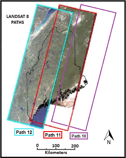
Please consult the map below to determine if your lake is on Path 12, 11 or Path 10. Please note that in some areas of the state there is overlapping of paths, so people can choose the most cloudless day given weather forecasts.
To view some of the previously collected data, please consult this list in PDF format.
Lakes are listed in numerical order, according to the lake’s MIDAS number.
Path 12 lakes begin on page 26. Please note: this list is not comprehensive.
The efforts of volunteers to collect Secchi data matching flyover dates of the Landsat 8 satellite is paying off, according to DEP Biologist Linda Bacon. This technology has the potential to be able to identify algae blooms from space! Bacon says that “volunteer data will be more valuable than ever to help calibrate the satellite.”
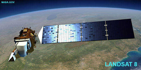
As the Landsat 8 satellite orbits the earth it takes photos of Maine lakes and ponds (as well as other features of the earth’s surface). The satellite images could be used to help characterize the transparency for many Maine lakes (thousands!) for which we do not have current water quality data. Volunteer lake monitors can play an important role in helping to “ground truth”, or calibrate the satellite images by taking Secchi disk transparency readings on the days when the satellite passes over Maine.

