 (1)")
 Ross Swain (2)")
 George Fergusson_Compress")
LSM Guidelines for Monitoring Metaphyton Density in Lakes
1. Download and print a bathymetric (depth) map for your lake at lakesofmaine.org. The map can serve as your survey form, or you can attach an additional sheet of paper with the documentation required below.

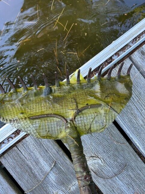
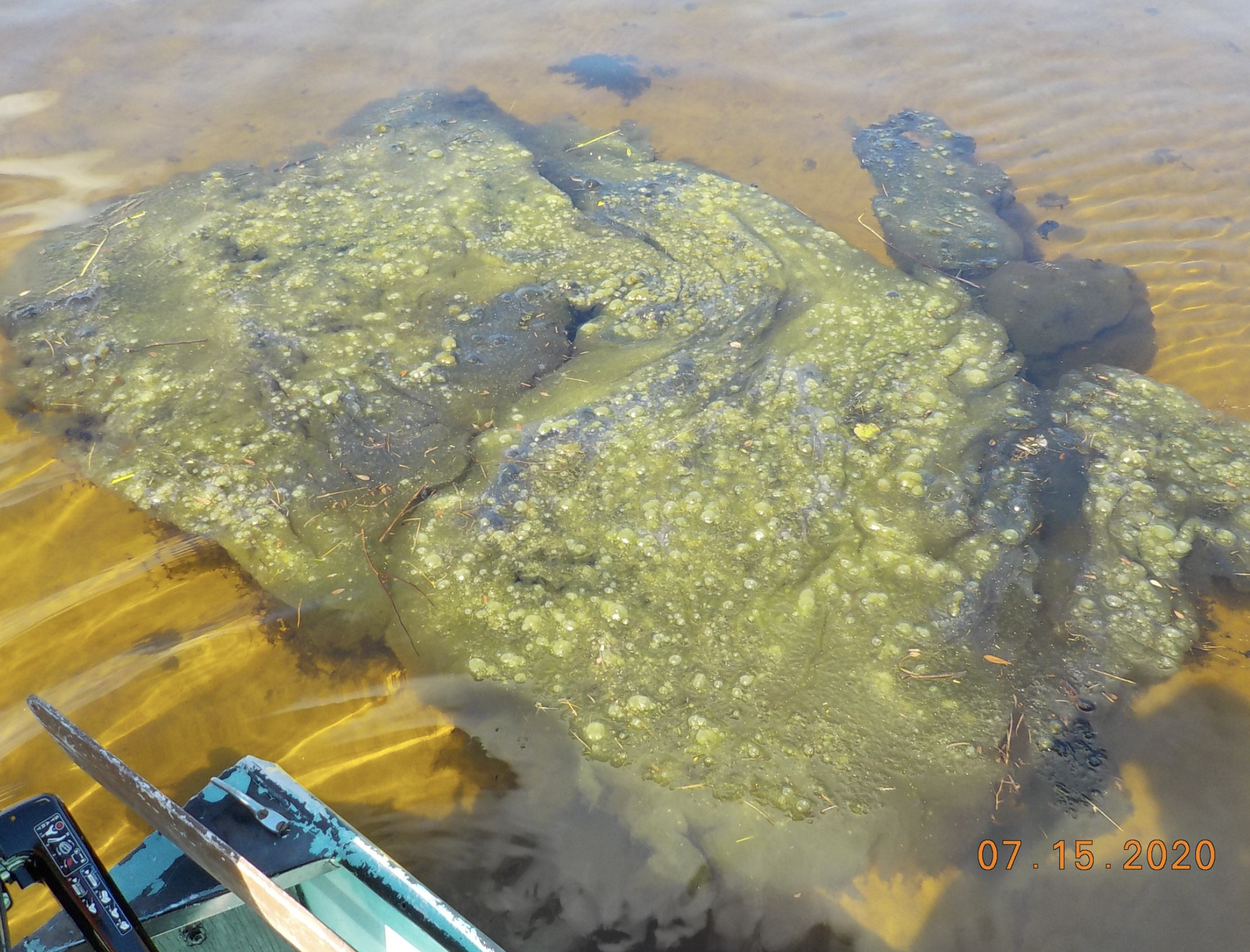
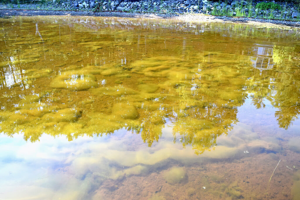
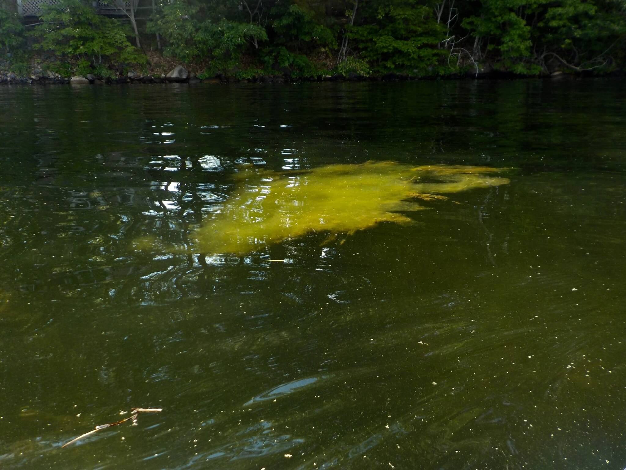
2. Use a highlighter to shade areas of the lake where significant metaphyton growth is observed (see example). Metaphyton occurs primarily in shallow areas that are protected from wind and wave action. Metaphyton is not rooted, but it commonly becomes entangled in the stems of rooted aquatic plants, where it can form clouds or “pillows”.
3. For each highlighted area that you have identified, indicate the approximate percentage of that area where metaphyton is observed. This can be written in the shaded area, or included in a text box (see example).
4. Indicate on the map: Your name; the lake name and MIDAS; current and recent weather (cloud cover, wind, precipitation, air temperature); the date(s) when the survey was done, as well as a location/site number for each area. For example: “ July 18, 2017; Site 3”.
5. If possible, include a photo for each site number. Photos can be taken from the surface if conditions are relatively calm and surface glare is minimal (see examples).
NOTE: If you submit photos as attachments, be sure to label the electronic files clearly, including the lake name and site number. Photos pasted on a field sheet (as illustrated) are more easily associated with your survey.
6. Ideally, all sites should be visited within a one week period. Additional maps can be used to document changes in metaphyton density throughout the open-water season.
LSM Metaphyton Form Usage
LSM Metaphyton Form Usage Quick Links How to use the LSM Metaphyton Tracking FormPresented by Tristan TaberRecorded on 2024-07-24 The presentation is step-by-step guide on using the LSM metaphyton tracking form. For any additional questions
Metaphyton in Our Maine Lakes
Metaphyton in Our Maine Lakes To download the PDF, simply click the button below. Download
Metaphyton Tracking Form
Metaphyton Tracking Form Please help the Lake Stewards of Maine (LSM) track metaphyton in our lakes! Using the form below you can submit observations of metaphyton. Thank you! For more information on metaphyton please see